Length: 10.5 mile, 2030 feet ascent
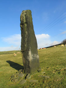
Emerging from Todmorden railway station, follow the road downhill to the left, turning left again passing under the railway bridge. Follow the narrow lane (Doghouse Lane) uphill passed the houses and then take the second signposted path on the left into the woods. Ascend the steep path through the woods following the short signed diversion. As we emerge from the wood we cross a step stile into a field. Now we follow the wall on our left to arrive at a gate next to a sheep pen. Passing through the gate we turn left along the wall heading directly for a small copse which we will pass on our left, to arrive at a gate in the wall near the top of the copse. Once through the gate, we keep the fence on our left and walk to the top of the field towards the finger post, pass through the gate at the top and turn left along a grassy track. With Dobroyd Castle on your left keep straight ahead at the next junction, and after 150m turn right in front of the iron fence and almost immediately left to emerge in a short distance onto a narrow metalled lane at Stones. Turn right and follow the lane for 30m to see a large standing stone in the field on your right at SD925 235.

Turn back to the junction of the paths and walk down the narrow road towards the telephone mast, turning off to the right after 100m and over a step stile into a field. Pass under the crags and turn left down the steep field, at the bottom turn right through a gateway and walk straight ahead across the next field to cross a deep gully and onwards towards Stones wood. Walk downwards through the wood, and descend some stone steps onto A681, turn right and cross over the road. Walk up the road for 230m then turn left into Gorpley Clough and follow the stream up. After admiring the waterfalls and crossing about 5 wooden bridges, turn up the stone steps on the right near the top of the clough. At the top of the steps turn right passing the waterworks building on your left.
Pass under Electric power lines and at top of the lane turn left onto gravel track passing under power lines again, and take the track going left. When you arrive at a gate across the road, push the button on the left to open the gate: it will close by itself when you have gone through. Once in the farmyard turn right and pass through a gate then follow the track all the way onto the moor until you cross the Clough near Range Hoyle SD900 228. Set your compass to 218°mag, and walk up the feint left hand path until you reach the broad track near to a spoil heap where you turn left. Keep walking along this broad track taking the right fork at a junction near to an old mine.
From the mine follow the continuation of the track, now less distinct, and climb up the hill until you arrive at the trig point on Trough Edge End SD905 218. From the trig point follow the track SE down through some ruins, where a track comes in from the right which passes Coolham and then down Foul Clough road. Watch for the step stile on the left at SD924 219” and follow the path in front of the house. Once passed the house, follow the fence on your right and cross over a stile in the bottom right corner of the field. You are now standing at the top of a steep wood on a narrow track passing from left to right. Turn left on the track and in 50m turn right onto a narrow path which you follow down into Walsden and over the railway bridge.

Cross the A6033 and walk up the road opposite, turning right after 50 yards onto canal towpath. Follow the towpath and at the second bridge turn left over canal and follow the metalled road passed a derelict mill, turning right into a very rough track which cuts the road corner. Emerge from the top of this track and turn right up the quiet lane until you reach North Hollingwood Farm where you take the left hand path along the Pennine Bridleway passing Rake End then turn left at Shurcrack Farm house to reach the road at SD942 231.
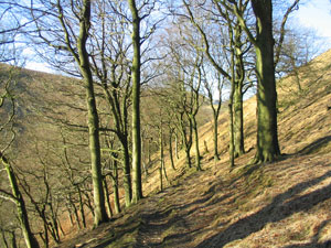
Once on the road, turn right and then first left down a farm track to join the Calderdale Way at the farm. In the farmyard turn left and find the step stile in the left hand corner. Cross the next field and over the stile into the riding stables. Walk through the stable yard and take the track on the left, turn right again within 20m onto another track and after a further 20m look out for the gate in the wall on your left. Cross two fields and turn right onto a rough lane. Follow this lane “which becomes tarmac” to the right, passing some houses on the left, down the side of a steep ravine passed the church and back into Todmorden.
Mick Melvin 2010